Old media using new media to cover the SoCal fires
If you visit Google Maps you might notice something new. A pair of little red text-based hyperlinks that map out all the important information on the SoCal fires engulfing San Diego, the southern border and parts north of and surrounding LA.
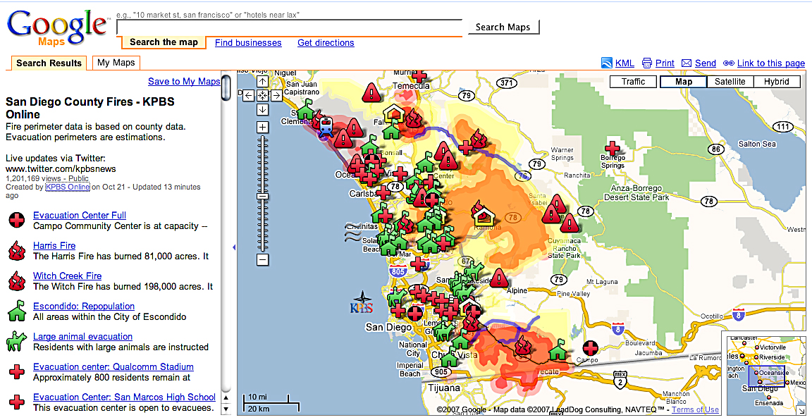
It's all there. Where to go to evacuate, where to take your animals, where the fires are ragging, where they are out, where the hospitals are, which roads are closed and opened and which areas are safe for residents to return to.
It's the infographic of new media, awesome!
The LA Times looks to behind the LA map and PBS radio affiliate KPBS created the San Diego map. What's interesting is that both are using existing technologies rather than creating them in-house (we can't all be the New York Times or Washington Post).
Google maps for data management and Twitter to feed the beast (hey, finally a use for twitter that makes sense), look to be fueling the pieces, very sweet.
This is something all the local papers should be doing, come on Orange County Register, San Diego Tribune and Riverside Press-Enterprise don't let the LA Times and some radio station show you up like that!
Labels: google maps, multimedia, news, SoCal fires
posted by S. Dulai at 5:17 PM
![]()
![]()


<< Home